Introduction: A New Era of Aerial Intelligence
The advent of unmanned aerial vehicle (UAV) technology has fundamentally reshaped the way modern armed forces gather intelligence, maintain situational awareness, and conduct surveillance across contested and uncontested environments. What once required manned reconnaissance aircraft operating at significant risk and expense can now be accomplished by unmanned platforms delivering persistent, high-resolution data streams directly to tactical and strategic decision-makers.
Intelligence, surveillance, and reconnaissance (ISR) represents one of the most critical pillars of modern military doctrine. The ability to see the battlespace clearly, understand adversary movements, identify threats before they materialize, and maintain continuous awareness of dynamic operational environments gives commanders a decisive advantage. UAV-based ISR has not merely supplemented traditional manned reconnaissance; it has expanded the scope, persistence, and granularity of aerial intelligence to a degree that was unattainable a generation ago.
Across the GCC region, Africa, and the broader global defense landscape, UAV ISR adoption is accelerating as nations recognize that persistent aerial intelligence is no longer an optional capability but a strategic necessity. From border surveillance to maritime patrol, from urban operations to vast desert monitoring, unmanned ISR platforms are proving indispensable across every operational domain.
UAV Platform Types for ISR Operations
The effectiveness of any ISR operation depends significantly on selecting the appropriate aerial platform for the mission profile. Modern unmanned systems span a wide spectrum of capabilities, each optimized for specific operational requirements.
Fixed-Wing UAV Platforms
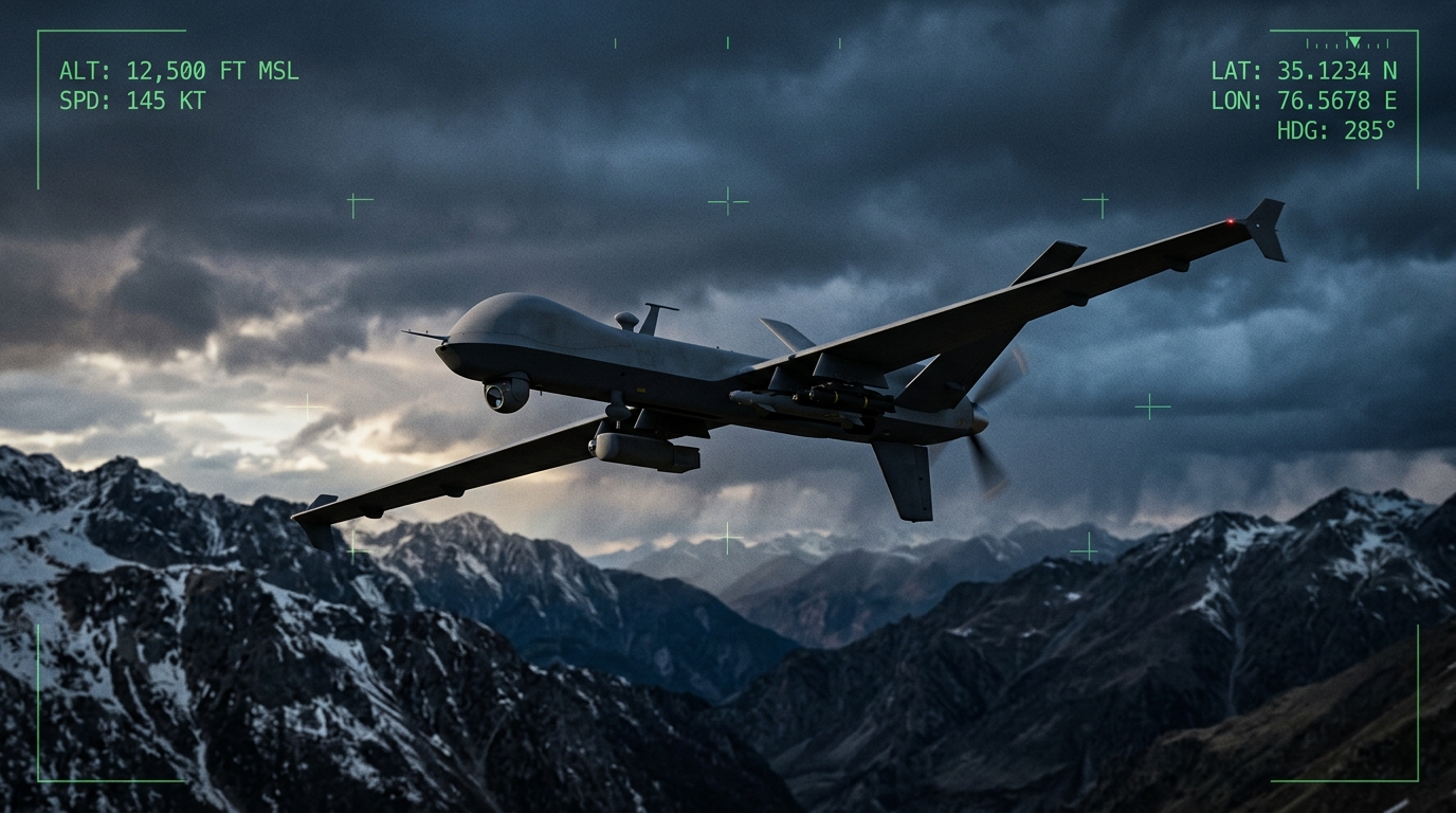
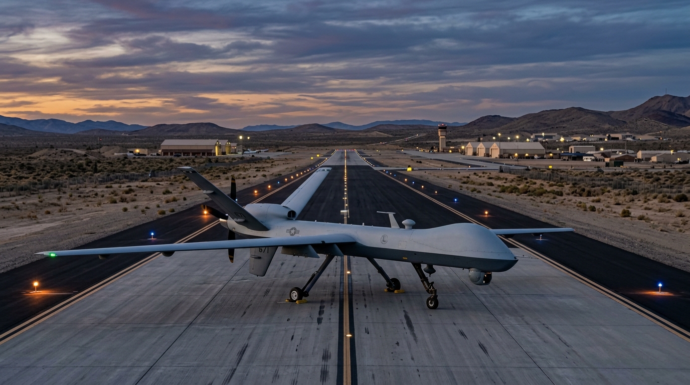
Fixed-wing unmanned aircraft represent the backbone of strategic and operational ISR capability. These platforms offer superior endurance, often remaining airborne for twelve to thirty-six hours on a single mission, depending on the airframe and propulsion system. Their aerodynamic efficiency enables them to cover vast areas of terrain, making them ideal for wide-area surveillance, border patrol along extended frontier lines, and maritime reconnaissance over open waters.
Fixed-wing ISR platforms typically operate at medium to high altitudes, providing broad area coverage while minimizing their acoustic and visual signature on the ground. Their extended range allows them to operate hundreds of kilometers from their launch point, relaying sensor data via satellite or line-of-sight data links back to ground control stations. For nations managing extensive territorial boundaries, such as those across the Arabian Peninsula and the Sahel region of Africa, fixed-wing UAV endurance is a critical force multiplier that transforms the economics of persistent surveillance.
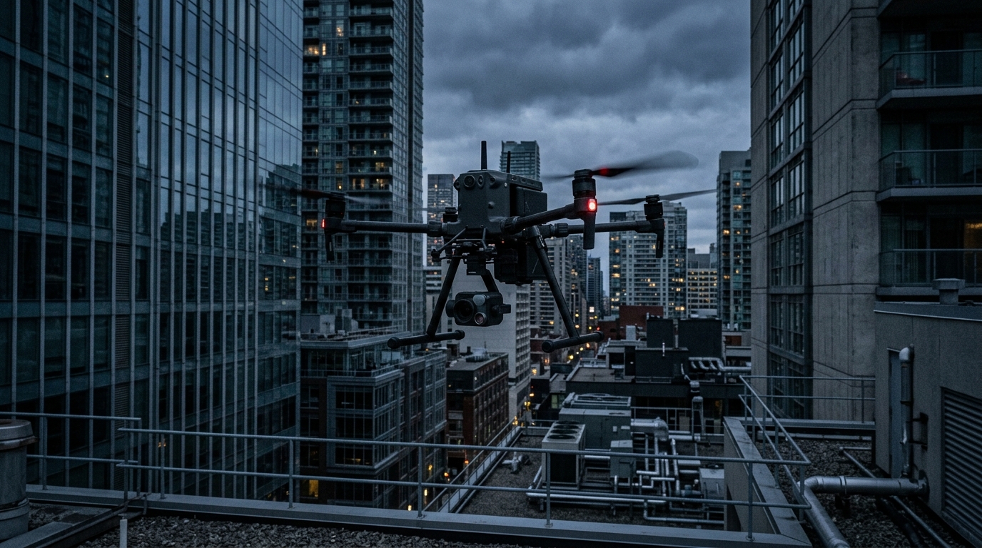
Vertical Takeoff and Landing (VTOL) Platforms
VTOL UAVs have emerged as essential assets for operations in confined or infrastructure-limited environments. Unlike fixed-wing platforms that require runways or launch systems, VTOL drones can deploy from small clearings, rooftops, ship decks, or forward operating bases without prepared surfaces. This flexibility makes them particularly valuable for urban surveillance, facility protection, convoy overwatch, and maritime deck-launched operations.
Modern VTOL ISR platforms combine the hover capability of rotary-wing designs with increasingly sophisticated sensor payloads. They can loiter over specific areas of interest, providing persistent stare capability that fixed-wing platforms cannot replicate without repeated orbit patterns. In security operations around critical infrastructure such as refineries, power plants, and government facilities, VTOL platforms offer rapid-deployment ISR that can be airborne within minutes of a security alert.
Multi-Rotor Tactical Systems
At the tactical level, multi-rotor UAVs provide infantry units, special operations teams, and security forces with organic ISR capability at the squad and platoon level. These small, man-portable systems can be deployed in minutes, providing immediate over-the-hill reconnaissance, building clearance support, and perimeter surveillance. While their endurance is limited compared to larger platforms, their low cost, rapid deployment, and minimal training requirements make them a ubiquitous tool in modern ground operations.
The integration of multi-rotor systems into tactical doctrine has democratized ISR capability, giving even small units the ability to understand their immediate operational environment before committing personnel to potentially dangerous situations. This shift has measurably reduced risk to ground forces while improving the speed and accuracy of tactical decision-making.
Sensor Payloads and Intelligence Capabilities
The true value of any ISR platform lies not in the aircraft itself but in the sensor systems it carries and the intelligence those sensors generate. Modern UAV payloads have reached levels of sophistication that enable multi-spectral, all-weather, day-and-night intelligence collection from a single airborne asset.
Electro-Optical and Infrared (EO/IR) Systems
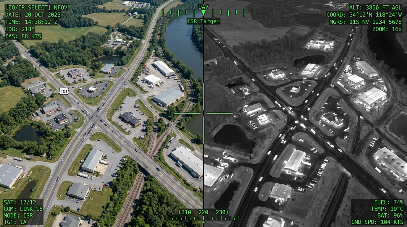
EO/IR camera systems form the primary sensor suite for the vast majority of ISR missions. High-resolution electro-optical cameras provide daylight imagery capable of identifying vehicles, personnel, and infrastructure details at operationally relevant standoff distances. Infrared sensors extend this capability into darkness, adverse weather, and through obscurants such as smoke and light dust, detecting thermal signatures that reveal human activity, vehicle movement, and equipment operation regardless of ambient lighting conditions.
Modern EO/IR gimbals integrate multiple sensor channels into a single stabilized turret, enabling operators to switch seamlessly between wide-area search modes and narrow-field identification modes. Advanced image stabilization compensates for platform vibration and atmospheric turbulence, ensuring that the imagery delivered to analysts and commanders is consistently sharp and actionable.
Multispectral and Hyperspectral Imaging
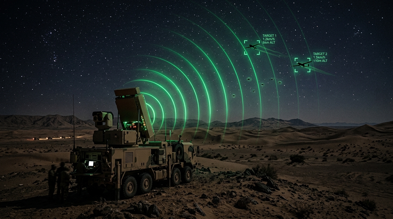
Beyond conventional visible and thermal imaging, multispectral sensors capture data across multiple discrete wavelength bands, revealing information invisible to standard cameras. These sensors can detect camouflaged positions, identify disturbed earth indicating recently placed objects, assess vegetation health to reveal concealed routes, and differentiate materials based on their spectral signatures. For border security and counter-infiltration operations, multispectral imaging provides a layer of detection that is extremely difficult for adversaries to defeat through conventional concealment techniques.
Synthetic Aperture Radar (SAR)
SAR-equipped UAVs can generate high-resolution ground imagery regardless of weather conditions, cloud cover, or time of day. Unlike optical sensors that depend on reflected light, SAR creates its own illumination using radar pulses, producing detailed ground maps that can detect moving targets, identify changes in terrain or infrastructure, and penetrate foliage canopy. For persistent area monitoring in regions subject to frequent sandstorms, heavy cloud cover, or extended periods of darkness, SAR provides the all-weather ISR backbone that optical sensors alone cannot guarantee.
Signals Intelligence (SIGINT) Capabilities
Certain ISR platforms carry electronic sensors designed to intercept, geolocate, and characterize electromagnetic emissions from communications devices, radar systems, and other electronic equipment. While the specifics of these capabilities are operationally sensitive, their strategic value in mapping adversary communication networks, identifying command nodes, and providing electronic order of battle information is well recognized across modern defense establishments.
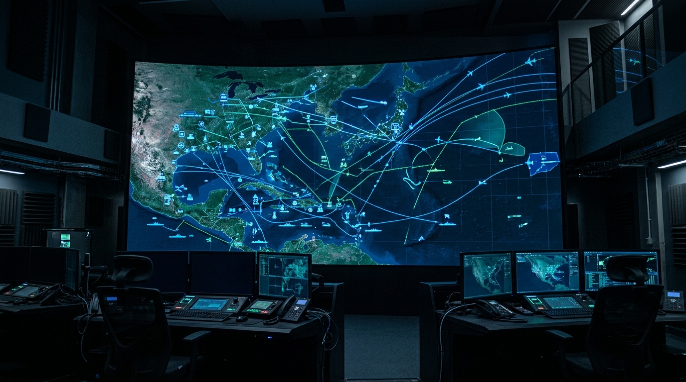
Operational Integration and Mission Planning
Deploying UAV ISR effectively requires more than simply launching a platform and collecting imagery. The full value of unmanned ISR is realized only when it is deeply integrated into the broader operational framework, from pre-mission planning through real-time exploitation to post-mission analysis.
Mission Planning Workflows
Modern ISR mission planning involves defining collection requirements based on intelligence priorities, selecting the optimal platform and sensor configuration, planning flight routes that maximize coverage while managing airspace deconfliction, and establishing data link and communication architectures. Automated mission planning tools enable operators to define areas of interest, specify revisit rates, and program sensor tasking sequences that the UAV executes autonomously, freeing operators to focus on interpreting the intelligence being collected.
Real-Time Video Downlink and Exploitation
One of the most transformative aspects of UAV ISR is the ability to stream live, full-motion video directly to ground commanders, operations centers, and distributed stakeholders simultaneously. This real-time downlink capability compresses the sensor-to-decision timeline from hours to seconds, enabling commanders to observe developing situations, direct forces in response to what they see, and make time-critical decisions with current rather than historical intelligence.
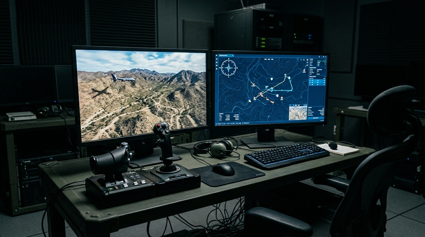
Automated Flight Paths and Autonomous Operations
Contemporary UAV platforms support a spectrum of control modes ranging from fully manual piloting through waypoint-based autonomous navigation to advanced autonomous behaviors including automatic target tracking, dynamic route replanning, and coordinated multi-vehicle operations. This automation reduces operator workload, increases mission consistency, and enables operations in communications-degraded environments where continuous operator control may not be possible.
Tactical Applications Across the Operational Spectrum
UAV-based ISR finds application across virtually every type of military and security operation, from strategic reconnaissance to tactical close support.
Border Surveillance: Extended-endurance UAVs provide persistent monitoring of border regions, detecting unauthorized crossings, smuggling activities, and infiltration attempts across terrain that would require thousands of ground-based personnel to monitor with equivalent coverage. Automated detection algorithms can alert operators to activity in designated zones, enabling focused human attention where it is most needed.
Convoy Escort and Route Clearance: UAVs operating ahead of ground convoys provide advance warning of ambush positions, improvised hazards, and route obstructions. This advance reconnaissance allows convoy commanders to reroute or prepare appropriate responses before encountering threats, significantly improving force protection.
Battle Damage Assessment: Following kinetic operations, UAV ISR provides rapid, detailed assessment of effects without requiring personnel to enter potentially hazardous areas. High-resolution imagery enables commanders to determine whether objectives have been achieved and whether follow-on action is required.
Search and Rescue: Thermal-equipped UAVs can rapidly search large areas for missing personnel, downed aircrew, or disaster survivors, covering in minutes what would take ground search teams hours or days. The ability to detect human thermal signatures against natural backgrounds makes UAV platforms particularly effective for search operations in desert, maritime, and wilderness environments.
Data Processing and Intelligence Production
The volume of data generated by modern ISR platforms is immense. A single medium-altitude UAV equipped with full-motion video and wide-area sensors can generate terabytes of data in a single mission. Converting this raw data into actionable intelligence requires sophisticated processing, exploitation, and dissemination (PED) capabilities.
Real-time analytics systems apply computer vision algorithms to identify objects of interest, track movement patterns, and flag anomalous behavior within the sensor feed. Pattern recognition capabilities can correlate activity observed over multiple missions, building a temporal understanding of adversary patterns of life, routine movements, and deviations from established behavior. Geo-referenced imagery enables every frame of video and every captured image to be precisely located on the earth's surface, supporting accurate targeting, navigation, and geospatial analysis.
The integration of artificial intelligence and machine learning into ISR data processing is rapidly advancing the speed and accuracy with which intelligence can be extracted from raw sensor feeds. Automated target recognition, change detection, and anomaly identification reduce the burden on human analysts while increasing the consistency and responsiveness of intelligence production.
Regional Context: UAV ISR Adoption in the GCC and Africa
Across the GCC member states, UAV ISR has become a cornerstone of national security architecture. The combination of vast territorial areas, extensive maritime boundaries, critical infrastructure concentrated in specific zones, and evolving threat environments has driven sustained investment in unmanned surveillance capability. Nations across the Gulf recognize that persistent aerial intelligence is essential for border security, maritime domain awareness, and the protection of energy infrastructure that underpins their economic stability.
In Africa, UAV ISR adoption is accelerating as nations confront security challenges spanning counter-terrorism, border control, anti-poaching enforcement, and maritime security. The continent's vast ungoverned spaces, limited road infrastructure, and diverse terrain make UAV platforms particularly valuable as force multipliers for security forces that must cover enormous areas with limited personnel. Regional organizations and international partnerships are facilitating technology transfer and capacity building, enabling African defense forces to develop organic ISR capabilities tailored to their specific operational contexts.
The growing regional demand for UAV ISR capability is also driving the development of local maintenance, training, and integration expertise. Rather than simply procuring platforms, forward-thinking defense establishments are investing in the human capital and institutional knowledge required to sustain and evolve their ISR capabilities over the long term.
Conclusion: The Future of Unmanned ISR
UAV-based ISR has transitioned from a niche capability employed by a handful of advanced militaries to a foundational element of modern defense operations worldwide. The convergence of increasingly capable and affordable platforms, sophisticated multi-sensor payloads, real-time data distribution, and AI-assisted analysis is creating ISR capabilities that would have been unimaginable a decade ago.
As platforms grow more autonomous, sensors become more capable, and data processing evolves from batch-oriented analysis to real-time automated intelligence production, the role of UAV ISR will only expand. For defense establishments in the GCC, Africa, and beyond, investing in unmanned ISR capability, along with the training, integration, and sustainment infrastructure to support it, represents one of the highest-return investments in modern defense readiness.
The challenge ahead lies not in the technology itself but in the organizational and doctrinal adaptation required to fully exploit it. Forces that successfully integrate UAV ISR into every level of their command structure, from strategic headquarters to tactical units in the field, will possess a decisive information advantage in the complex security environments of the coming decade.