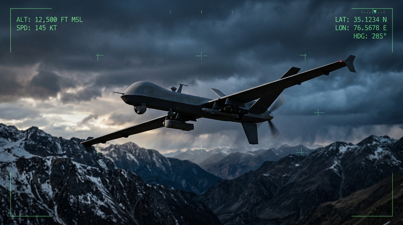
The Growing Drone Threat in the GCC
The Gulf Cooperation Council region is experiencing an unprecedented proliferation of unmanned aerial systems. What began as a gradual adoption of commercial drones for photography, surveying, and logistics has rapidly evolved into a complex security challenge that affects military installations, critical infrastructure, government facilities, and public gatherings across all six GCC member states.
Commercial drones are now widely available throughout the region, with consumer-grade platforms capable of carrying payloads of several kilograms, flying at altitudes above 400 meters, and operating at ranges exceeding 10 kilometers from the pilot. The cost of entry has dropped dramatically over the past five years, placing capable aerial platforms in the hands of virtually anyone willing to purchase one. While regulatory frameworks have been introduced across the GCC, enforcement remains inconsistent, and the sheer volume of drone activity makes comprehensive airspace monitoring a formidable undertaking.
Beyond the regulatory dimension, the asymmetric use of drones in regional conflicts has demonstrated their effectiveness as tools of disruption, surveillance, and in the most concerning scenarios, direct attack. Modified commercial platforms have been employed for intelligence gathering against sensitive sites, smuggling across borders, and as improvised weapons delivery systems. These incidents have fundamentally altered the threat calculus for defense planners across the Gulf, elevating counter-UAS from a niche concern to a core component of national defense architecture.
Threat Vectors: How Drones Are Being Used
Understanding the counter-UAS challenge requires a clear assessment of how unmanned systems are being employed as threat vectors. The primary categories of concern for GCC defense establishments include the following.
Low-altitude intrusion represents perhaps the most common threat vector. Small drones operating below 150 meters can evade many conventional air defense radars that were designed to track larger, faster-moving aircraft at higher altitudes. These low-altitude incursions are particularly difficult to detect over urban areas where buildings create radar shadows and RF environments are dense with competing signals.
Surveillance and intelligence gathering poses a persistent concern for military bases, government compounds, and critical infrastructure sites. A drone equipped with a high-resolution camera can loiter at a distance and capture detailed imagery of facility layouts, security patrol patterns, vehicle movements, and personnel activity without the operator ever entering a restricted zone on the ground.
Smuggling and contraband delivery has emerged as a growing problem, particularly along border regions and around correctional facilities. Drones can transport small packages across barriers that would otherwise require significant effort to breach, bypassing physical security measures entirely by exploiting the vertical dimension.
Weaponized drones constitute the highest-consequence threat category. Modified commercial platforms can carry and release explosive payloads, or be configured as loitering munitions that fly directly into a target. The conversion of a consumer drone into an improvised weapon requires minimal technical expertise and very modest investment, making this capability accessible to a wide range of potential adversaries.
Swarm tactics represent the frontier of drone-based threats. Multiple coordinated drones can overwhelm point-defense systems designed to engage single targets, saturate sensor coverage, and create confusion among response teams. While fully autonomous swarm operations remain at an early stage, semi-coordinated multi-drone attacks have already been documented in regional conflict zones.
Detection Technologies: The Sensor Arsenal
Effective counter-UAS operations begin with reliable detection. No single sensor technology can address every aspect of the drone threat, which is why modern systems employ multiple complementary detection modalities. Each technology brings specific strengths and limitations that defense planners must understand when designing airspace protection architectures.
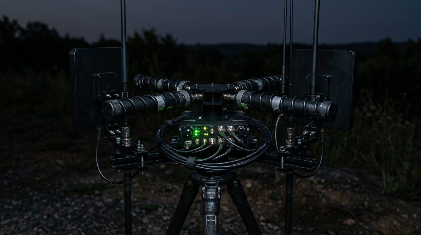
Radio-Frequency Detection
RF detection systems passively monitor the electromagnetic spectrum for signals associated with drone control links, telemetry transmissions, and video downlinks. When a drone communicates with its ground controller, it emits RF energy across specific frequency bands that can be intercepted, analyzed, and classified by purpose-built receivers. RF detection offers several advantages: it is entirely passive, meaning it does not emit any signals itself and therefore cannot be detected by the target; it can provide early warning at considerable ranges, often detecting a drone before it becomes visible to radar; and it can simultaneously identify and geolocate both the drone and its operator. However, RF detection is ineffective against drones operating autonomously on pre-programmed GPS waypoints with no active communication link. Additionally, performance degrades in environments with high RF congestion, such as dense urban areas or near major telecommunications infrastructure.
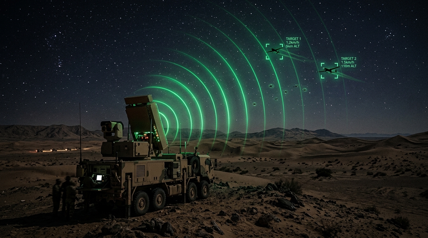
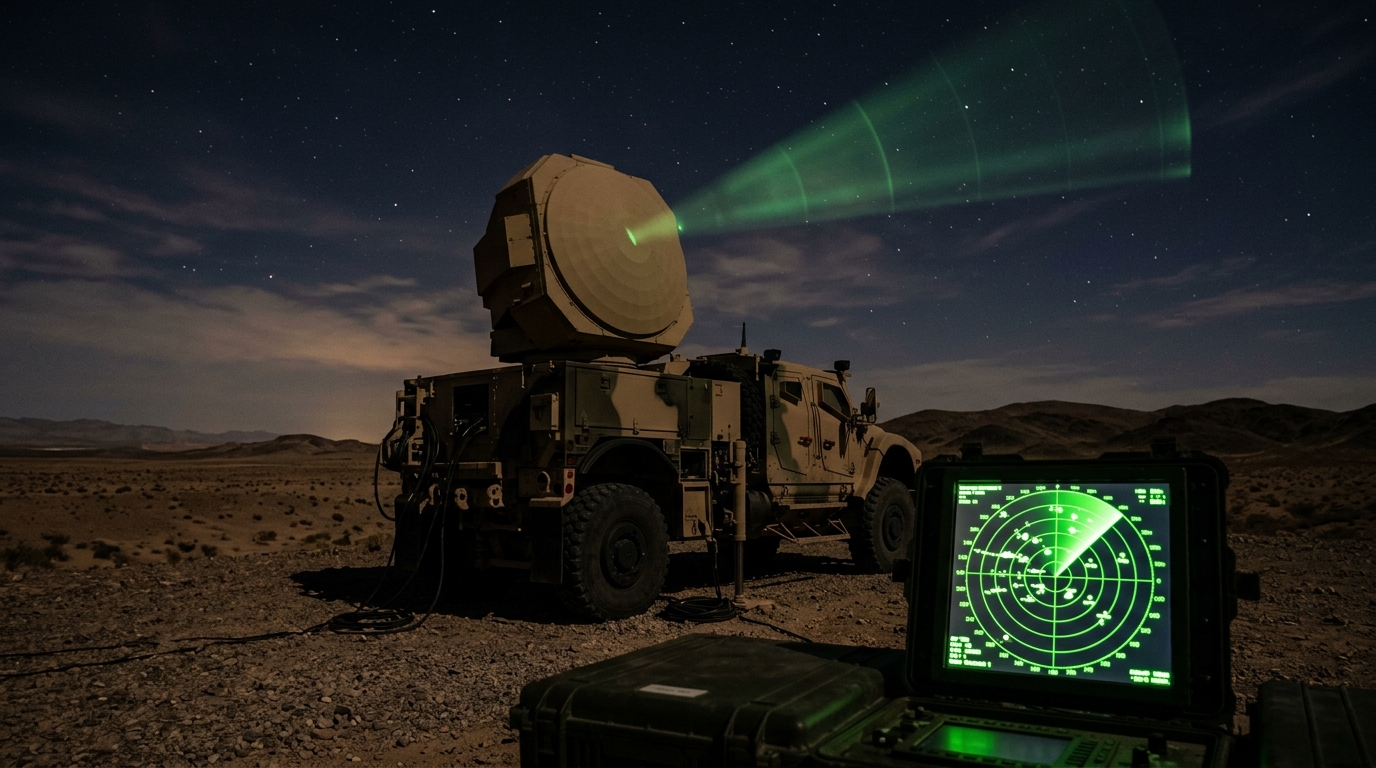
Radar Systems
Radar provides the most reliable all-weather detection capability and is the backbone of most counter-UAS architectures. Two-dimensional surveillance radars provide bearing and range information, enabling operators to track drone movements across broad sectors. Three-dimensional radars add altitude data, which is critical for distinguishing drones from ground-level clutter and for guiding effectors to the correct engagement altitude. The challenge for radar-based drone detection lies in the small radar cross-section of most commercial drones. A typical consumer quadcopter may present a radar signature comparable to that of a large bird, making discrimination between drones and legitimate airborne objects a significant signal-processing challenge. Advanced radar systems address this through Doppler analysis of the distinctive micro-motion signatures produced by rotating propellers, a technique that can reliably distinguish drone returns from bird returns in most conditions.
Acoustic Sensors
Acoustic detection systems use arrays of sensitive microphones to detect and localize the distinctive sound signatures produced by drone motors and propellers. Each drone type produces a characteristic acoustic fingerprint based on its motor configuration, propeller design, and operating RPM. By analyzing these sound patterns against libraries of known drone signatures, acoustic systems can detect, classify, and track drones within their effective range. The primary advantage of acoustic detection is its ability to detect drones that may be invisible to RF sensors, such as those operating autonomously. Acoustic sensors also perform well in GPS-denied environments and can provide useful detection in cluttered urban settings where radar may struggle. However, their effective range is limited compared to RF and radar systems, and performance deteriorates in high-ambient-noise environments such as industrial facilities, airports, and areas near highways.
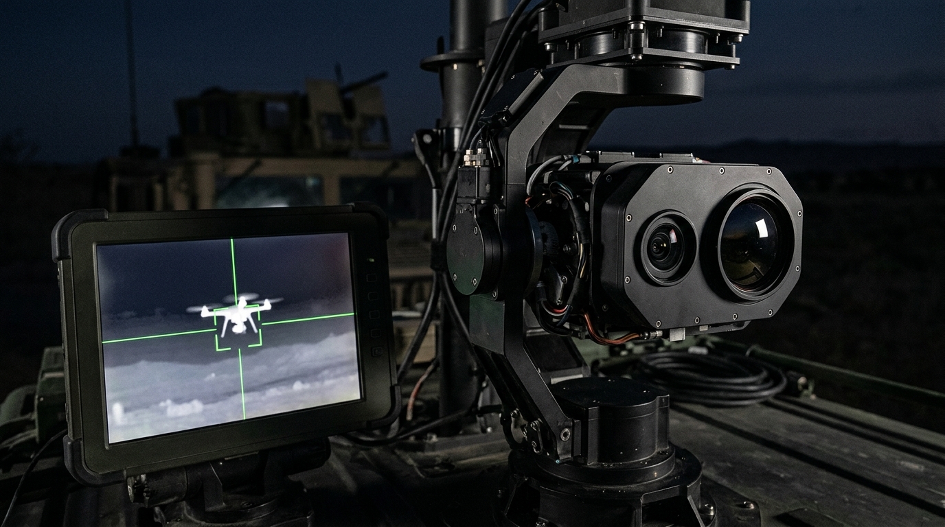
Electro-Optical and Infrared Cameras
EO/IR systems provide visual confirmation and tracking of detected targets. High-resolution daylight cameras offer positive visual identification at considerable distances, while thermal infrared sensors detect the heat signatures of drone motors and batteries, enabling detection and tracking in darkness and low-visibility conditions. EO/IR systems are essential for the classification and identification stages of the detection chain, providing human operators with the visual evidence needed to confirm whether a detected object is genuinely a drone, determine its type and configuration, and assess whether it is carrying a payload. These systems typically operate as secondary sensors, cued by initial detections from RF, radar, or acoustic systems, rather than as primary wide-area search sensors.
The Multi-Layered Defense Imperative
The limitations inherent in each individual sensor technology make it clear that no single detection modality can provide comprehensive airspace protection. An RF system alone will miss autonomous drones. Radar alone will struggle to distinguish small drones from birds without additional sensor cueing. Acoustic sensors alone lack the range for early warning. EO/IR alone cannot maintain persistent wide-area surveillance.
This reality drives the fundamental principle of modern counter-UAS architecture: sensor fusion. By integrating multiple detection technologies into a unified system, defense operators achieve detection coverage that compensates for the blind spots and limitations of each individual sensor. When an RF system detects a control link, it can cue the radar to search a specific sector. When radar tracks a potential target, it can slew an EO/IR camera to obtain visual confirmation. When acoustic sensors detect motor noise in a direction consistent with a radar track, the correlation increases confidence that the target is genuinely a drone rather than a false alarm.
The fusion of sensor data also enables more effective response. By combining range, bearing, altitude, speed, heading, and classification data from multiple sources, integrated systems can provide response teams with a comprehensive operational picture that supports timely and proportionate decision-making. This is particularly important in environments where rules of engagement may restrict the use of kinetic countermeasures, requiring operators to have high confidence in target identification before initiating any response action.
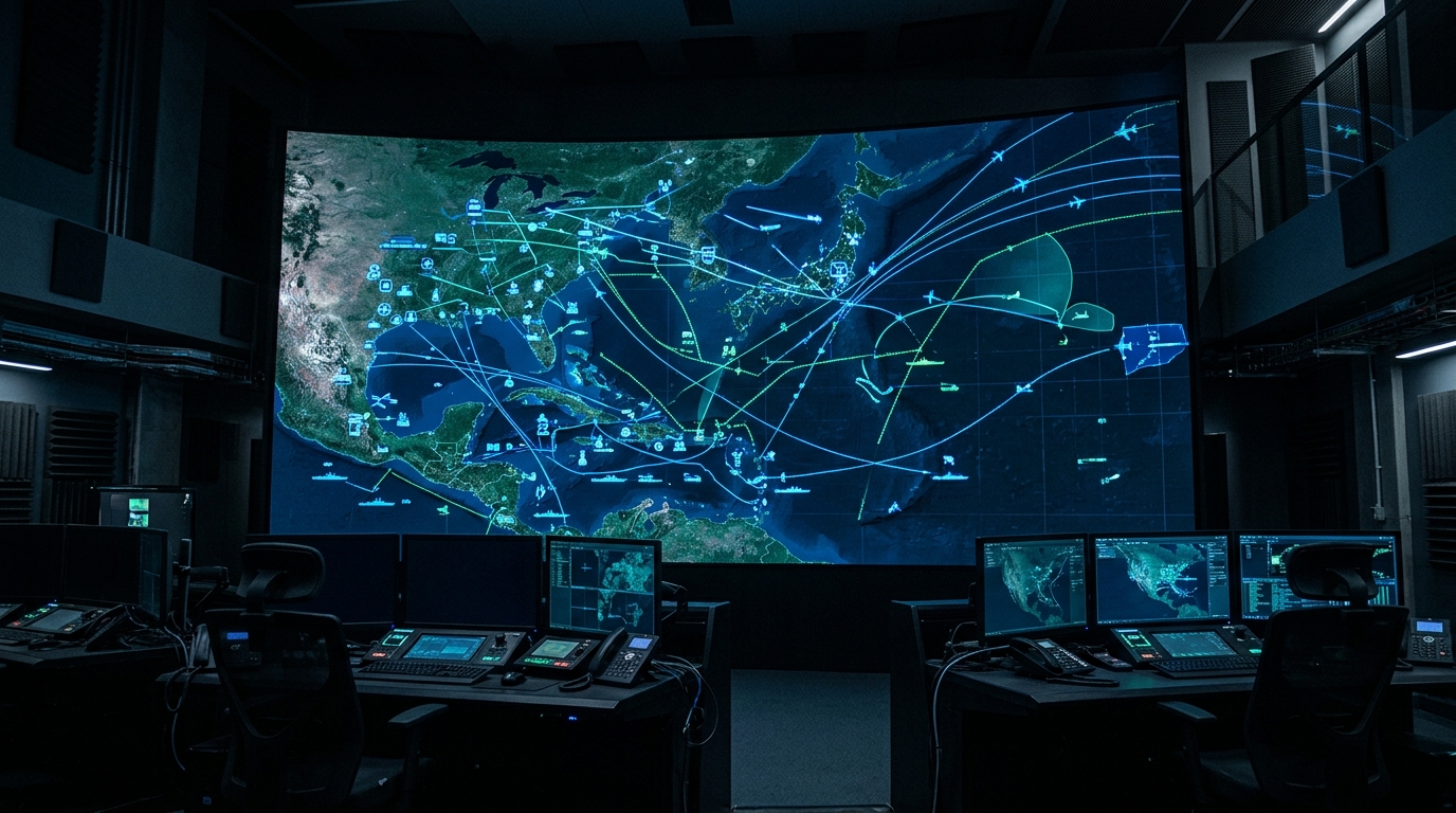
Command-and-Control Integration
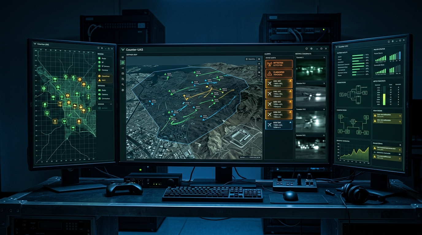
Detection without effective command and control is merely observation. The value of a counter-UAS detection architecture is realized only when sensor data flows seamlessly into command platforms that enable rapid assessment, decision-making, and response coordination.
Modern counter-UAS command-and-control platforms aggregate sensor feeds from all detection modalities into a single unified operational display. Operators see a fused air picture that shows detected tracks with associated classification data, confidence levels, and predicted trajectories. Alert thresholds can be configured to automatically escalate tracks that meet specific threat criteria, such as drones approaching restricted zones, operating at altitudes inconsistent with authorized flight plans, or displaying flight patterns associated with hostile intent.
Integration with broader air defense and security management systems is equally important. Counter-UAS detections must be correlated with data from air traffic control systems to distinguish authorized drone operations from unauthorized incursions. They must feed into physical security management platforms so that ground response teams can be dispatched to the operator's estimated location. And in military contexts, counter-UAS data must integrate with theater-level air defense networks to maintain a coherent operational picture across all aerial threat categories.
Regional Considerations for GCC Deployments
Deploying counter-UAS systems in the Gulf region introduces environmental and operational factors that differ significantly from temperate-climate deployments. Defense planners and system integrators must account for these regional specificities to ensure reliable performance.
Desert heat effects on sensors are a primary concern. Ambient temperatures in the Gulf routinely exceed 50 degrees Celsius during summer months, with ground surface temperatures reaching considerably higher. These conditions affect electronics reliability, reduce the thermal contrast that IR sensors depend upon for detection, and can create atmospheric refraction effects that degrade radar accuracy at low elevation angles. Equipment shelters, active cooling systems, and heat-hardened components are essential requirements for sustained operations in these environments.
Urban RF clutter in Gulf cities presents a significant challenge for RF-based detection. Cities such as Riyadh, Jeddah, Abu Dhabi, and Doha have exceptionally dense telecommunications infrastructure, including 5G networks, satellite uplinks, broadcast transmitters, and industrial RF sources. This electromagnetic congestion raises the noise floor against which RF detection systems must discriminate drone signals, demanding higher-sensitivity receivers and more sophisticated signal-processing algorithms than would be required in less congested environments.
Coastal and maritime environments affect radar performance along the extensive Gulf coastline. Sea clutter from wave returns can mask low-altitude drone tracks, particularly in rough sea states. Humidity and salt-laden air can accelerate equipment degradation and affect the propagation characteristics of both radar and RF detection signals. Counter-UAS systems deployed in coastal settings require marine-grade environmental protection and radar processing modes optimized for maritime conditions.
Sand and dust are persistent operational challenges across the region. Shamal wind events can carry dense dust loads that obscure EO/IR sensors, deposit abrasive particles on mechanical systems, and infiltrate electronic enclosures. Systems intended for Gulf deployment must incorporate sealed optics, positive-pressure electronics housings, and automated lens-cleaning mechanisms to maintain operational availability during and after dust events.
The Path Forward for GCC Airspace Protection
The counter-UAS threat in the GCC is not a static challenge. Drone technology continues to advance rapidly, with each generation of commercial platforms offering greater range, higher payload capacity, improved autonomy, and reduced cost. The threat actors seeking to exploit these capabilities are similarly adaptive, employing new tactics and modifying platforms to evade detection.
Meeting this evolving challenge requires defense architectures that are equally adaptive. Multi-layered sensor networks must be designed for modularity, enabling the integration of new detection technologies as they mature. Command-and-control platforms must support open architectures that can incorporate additional sensor feeds and effector types without requiring wholesale system replacement. And operational procedures must be continuously refined based on threat intelligence, exercise outcomes, and operational experience.
For GCC member states, the investment in comprehensive counter-UAS capability is not optional. The convergence of high-value assets, demonstrated threat activity, and challenging environmental conditions demands a defense posture built on layered detection, integrated command and control, and flexible response options. The organizations and defense forces that establish these capabilities now will be positioned to protect their airspace as the drone threat continues to evolve in sophistication and scale.